Short Ditch Extension

Short Ditch Extension
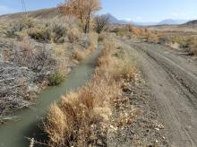
The Short Ditch begins in what was once described as Midway, a point in the valley of the North Fork of the Gunnison south of Paonia and north of Hotchkiss. From here it follows the base of the ridges and slopes to its terminus south of Hotchkiss. It is defined as a mutual ditch and was originally owned and operated by The Short Ditch Company. The segment of the ditch in this Storymap is owned by the Short Ditch Extension Company. A Bureau of Reclamation Salinity Control Program project is piping, adding a siphon, and removing sections of the ditch's historic alignment. The ditch has not been completely documented and is recommended as needing additional data prior to determinaiton of it's eligibility to the National Register of Historic Places. As an early water project in the vicinity of Paonia and Hotchkiss, this ditch may have significantly impacted the local community. Records indicate 2,565-acres of farmland are currently irrigated by this structure. The Bureau of Reclamation determined that the project will have an adverse effect on the ditch. This Story Map mitigates the project's adverse effects.
Authors: Nicole Inman, Grand River Institute
Keywords: Ditch, Irrigation, Bureau of Reclamation
